Water is life.
The rivers of life don’t only flow in the visible world.
Hidden in the darkness, deep beneath us,
there are just as many rivers.
It is our duty to continue discovering and exploring life,
uncovering its secrets, and bringing them to light.
The Hidden River Project
– Reseau de l’Ouysse –
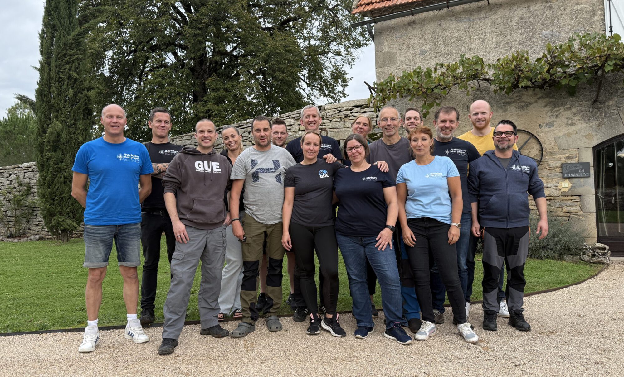
In 2009, a group of ambitious cave divers from various countries started a joint project in a cave in the Département du Lot, in southern France.
The cave, known as Gouffre de Cabouy is part of a larger river system, the Reseau de l’Ouysse.
Our initial objective was to improve the confusing line situation in the first two kilometres of the cave but over time our project goals became more and more ambitious and eventually it became known as “the hidden river project”.
History
Safe navigation is paramount in cave diving and a continuous guideline is essential for ensuring a safe return to the surface. Historically, the line situation in the first 2 km of the Cabouy was extremely confusing with up to 14 overlapping lines and many broken sections.
Our first goal was to resolve the guideline situation by replacing all the lines with a single, continuous line through the cave. This was achieved in 2010 after two major efforts. Motivated by our success, the team set new and more ambitious project goals to explore and survey the cave beyond its known parts as well as to gather additional hydrological measurements.
Our motivation
Our main motivation is our shared passion for cave diving.
These projects are strenuous, exhausting, and even a bit daunting, but they are also deeply rewarding. They challenge us, bring us closer as a team, and ignite our fascination for the unknown.
Our dedication to cave exploration is evident in the time, effort, and our personal investments over the years. We have financed our training, equipment, and scientific tools, such as sensors and surveying devices, entirely from our own resources. Our collective achievements since 2009 continue to motivate us to continue, even as the challenges grow with each year.
Benefits to others
Since our first dives, we have been systematically surveying the cave and installing sensors to collect more refined data about the annual water movement. These findings, including maps and water data, are publicly available upon request and as contribution to the scientific research.
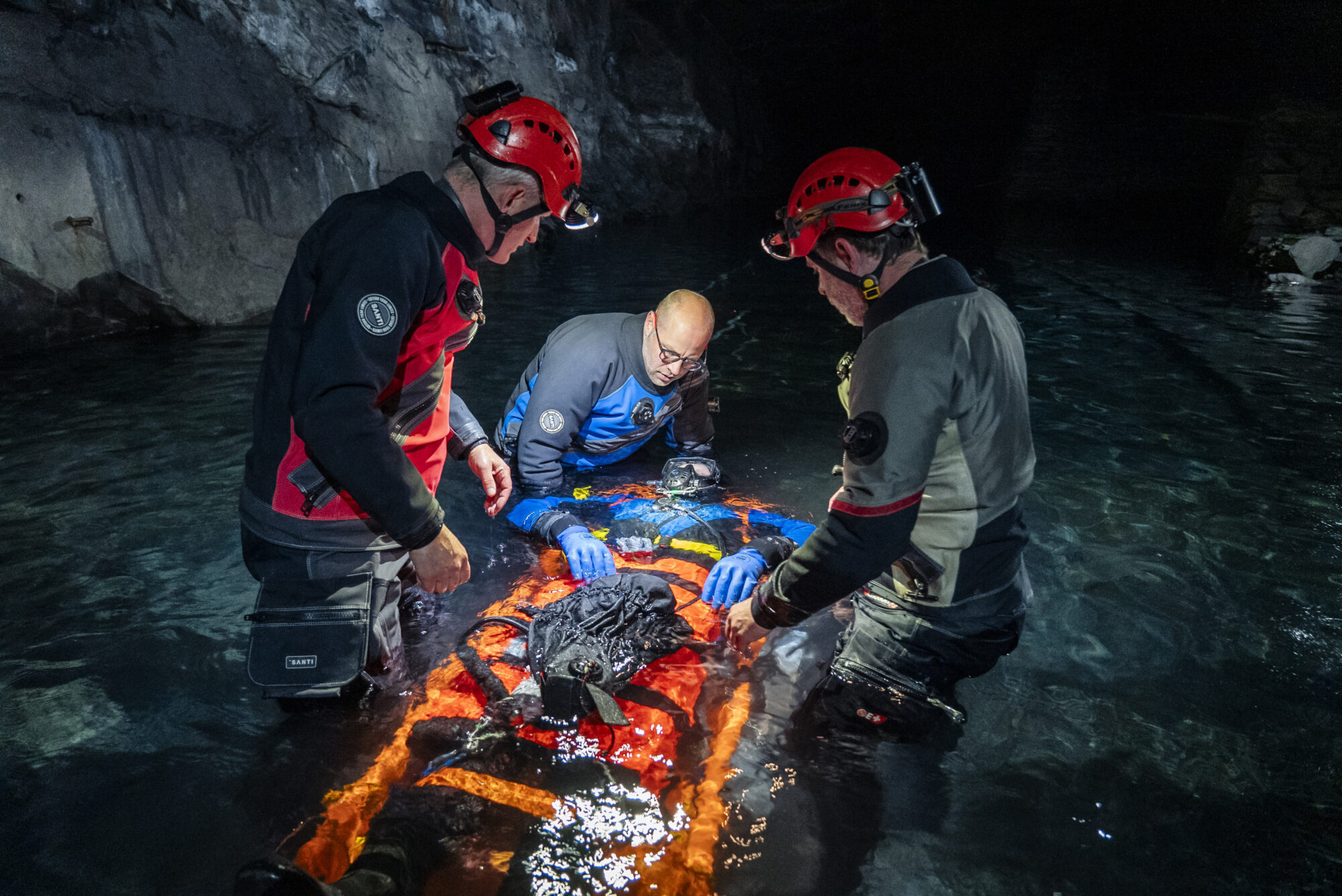
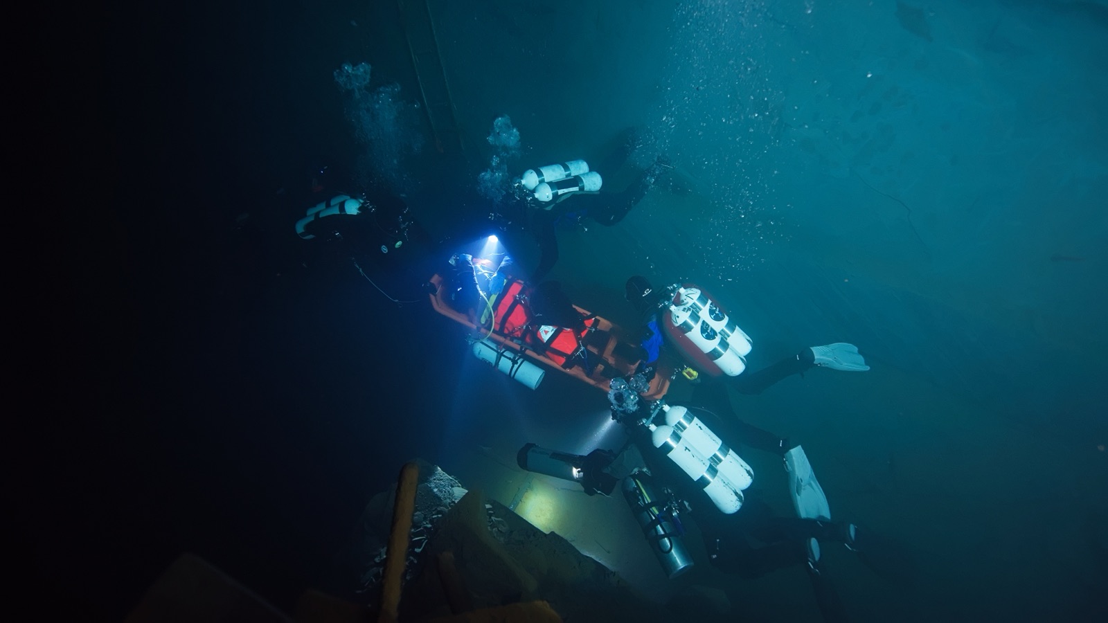
In addition to the ongoing exploration and mapping of the cave, we have refined a system for potential rescue and recovery operations from water-filled cave systems. Cave diving is inherently risky, which is why each member of our team is highly trained and we prioritize safety. Early on, we developed various emergency protocols and worked on addressing the immense challenge of providing medical care and transporting an injured person from deep inside the cave.
The Thailand cave rescue in 2018 (Wikipedia) highlighted the limitations of traditional rescue teams in such situations. Over the years our team trained for various long distance underwater evacuations, and we have supported other rescue teams with our practical experience.
Results
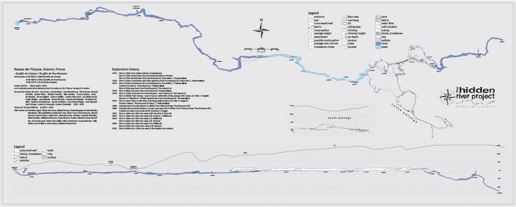
Map: So far we have surveyed more than 6.2 km of cave passages (both under and above water). The furthest explored point in the cave is currently 4 km from the entrance, but to next known point of the l’Ouysse remains approximately 15 km of unexplored passages, offering tremendous potential for future discoveries.
The current status of the mapping is available as a PDF document: Reseau de l’Ouysse
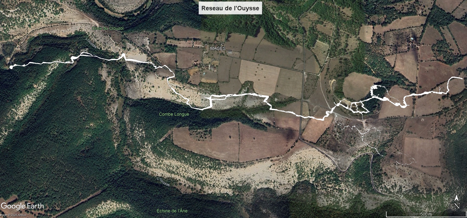
If you have Google Earth, you can see the results embedded in the landscape: Google Earth
cave maps:
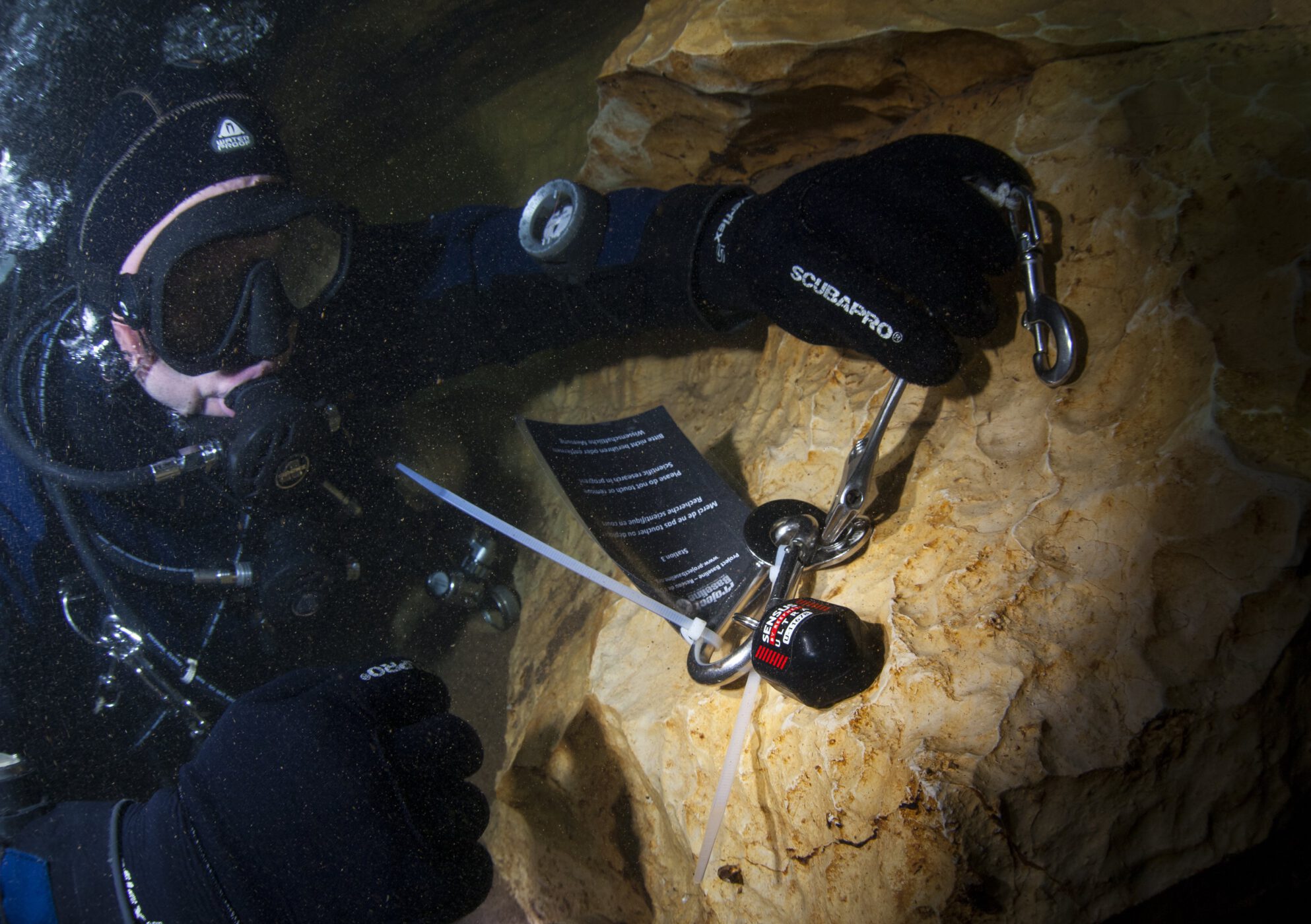
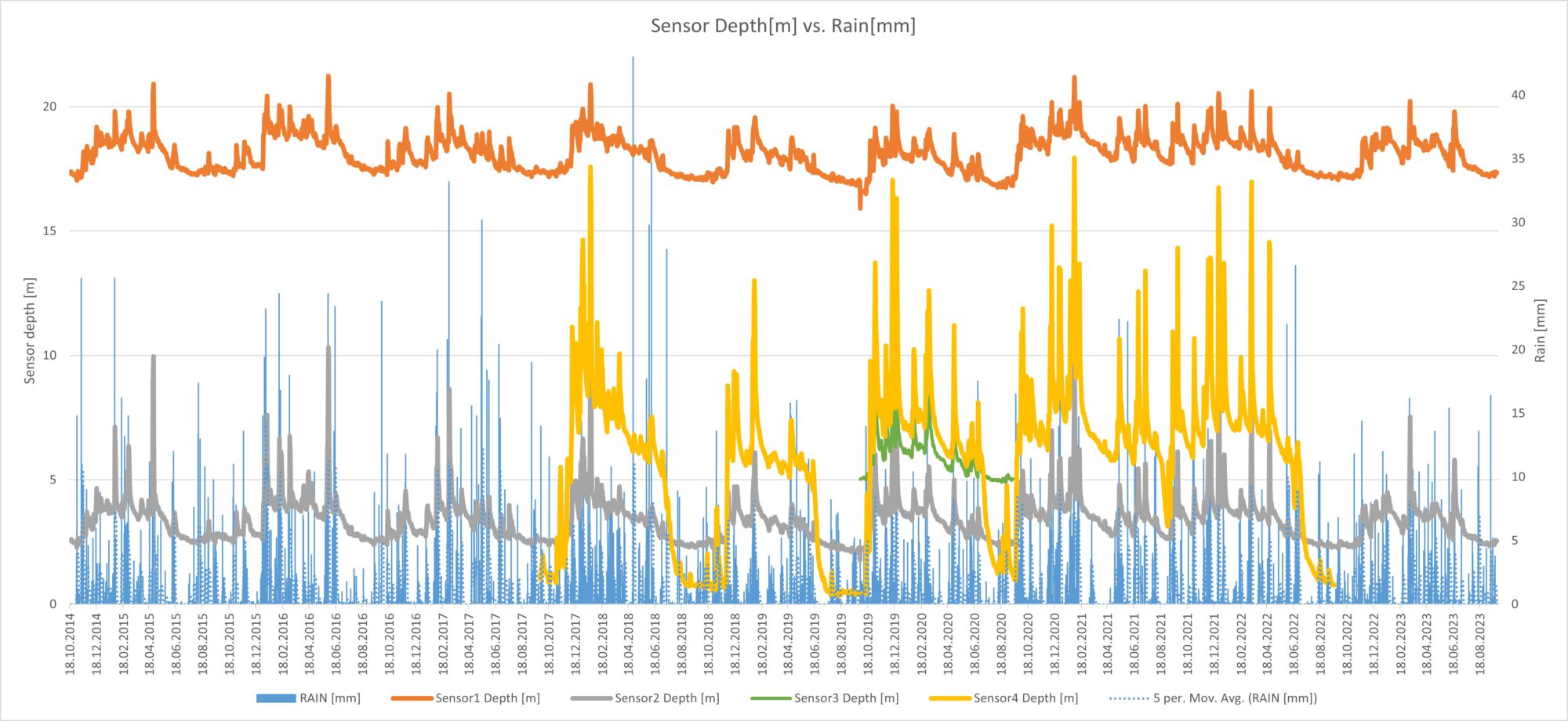
Sensors: From our installed sensors throughout the cave we collected data from 2014 to 2025, including water level and temperature measurements. The conditions in the cave are quite harsh, especially in the winter months. Rainfall and meltwater cause strong currents with a lot of sediment in the water. During this time, diving in the cave is usually impossible and even some of our data sensors have stopped working due to the mechanical strain they are under these harsh conditions. Despite these challenges, we’ve compiled a valuable dataset, which we are happy to provide upon request for any scientific purposes (mail address see below).
Rescue: We have developed a rescue system that can transport an injured person over a long diving distance. Our team trains with this system again and again and would therefore be able to provide assistance in an emergency that hopefully never occurs.
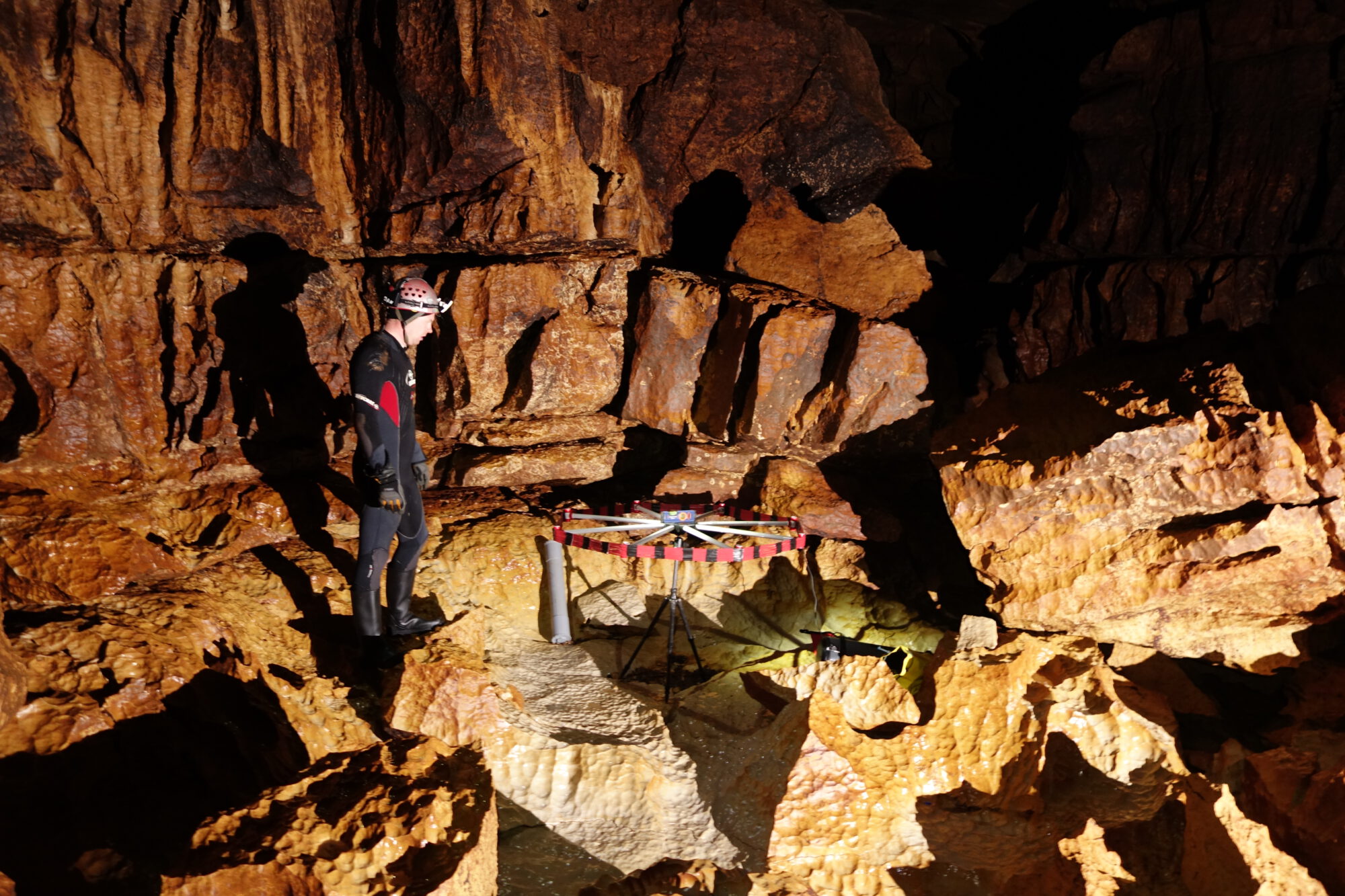
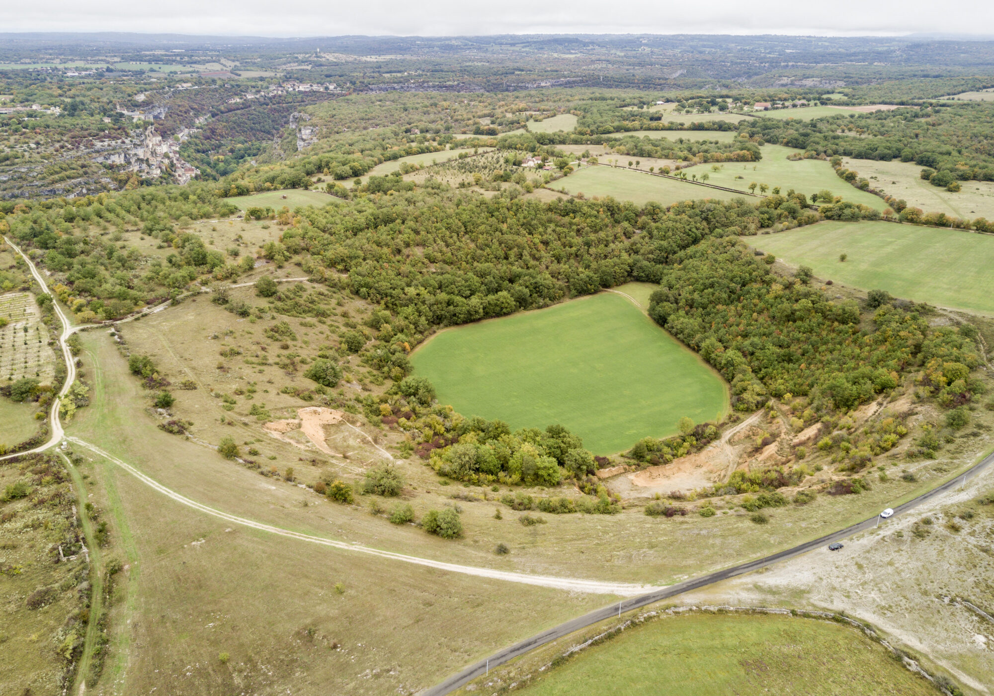
Radio location: In collaboration with French speleologists, we carried out a „radio location“ survey in 2015, accurately pinpointing a dry passage within the cave system at 120 m below the surface using GPS coordinates.
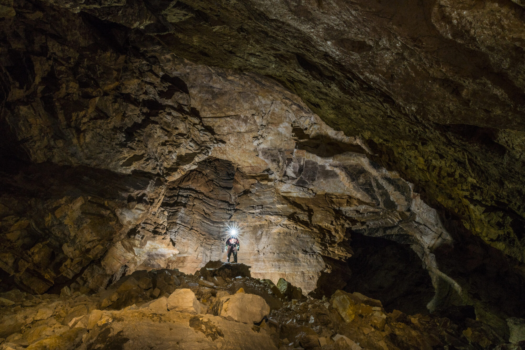
The cave and its challenges
In the French Département du Lot and near the town of Themine, the river l’Ouysse vanishes underground and resurfaces about 30 km downstream near the town of Rocamadour at the „Gouffre de Cabouy“.
From the Cabouy resurgence, our group explores the cave system. We meticulously measure all passages, and draft accurate cave maps. In addition we collect data on water level and water temperature which we combine with precipitation records to analyze to derive connections between rainfall and the impact on the cave environment.
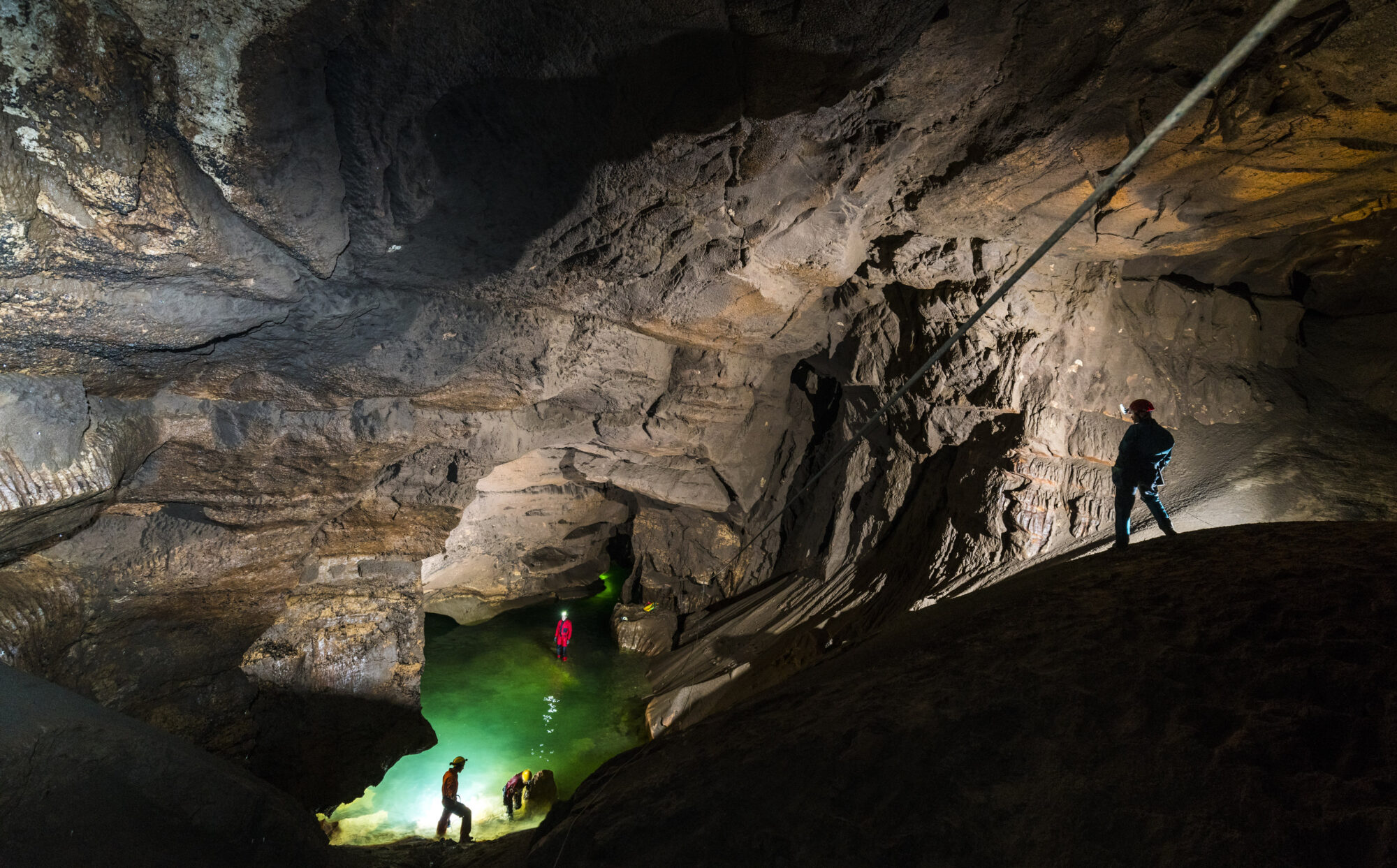
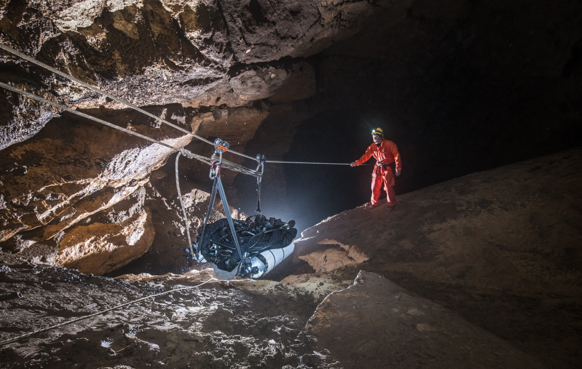
The cave system can be divided into five different sections:
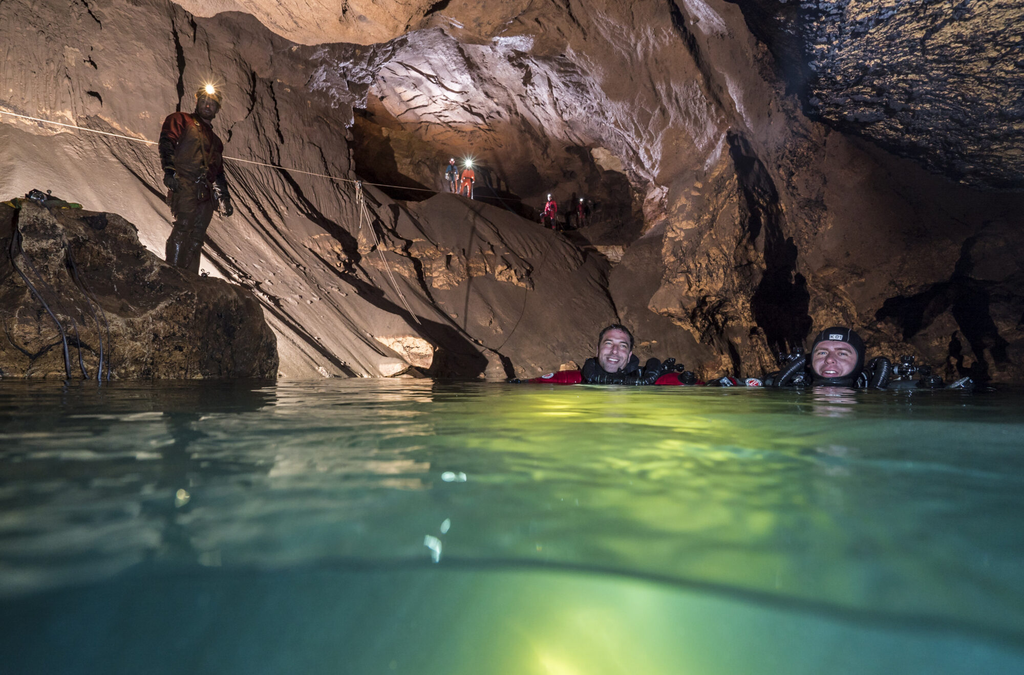
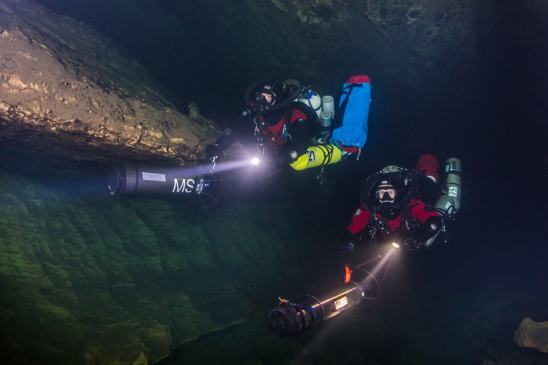
Sump 1: The initial diving section of approximately 2 km length and 30 m depth. This part can be managed relatively easily even with a lot of equipment, provided the diving conditions are good enough. Good and diveable conditions are usually only found for a short period in autumn.
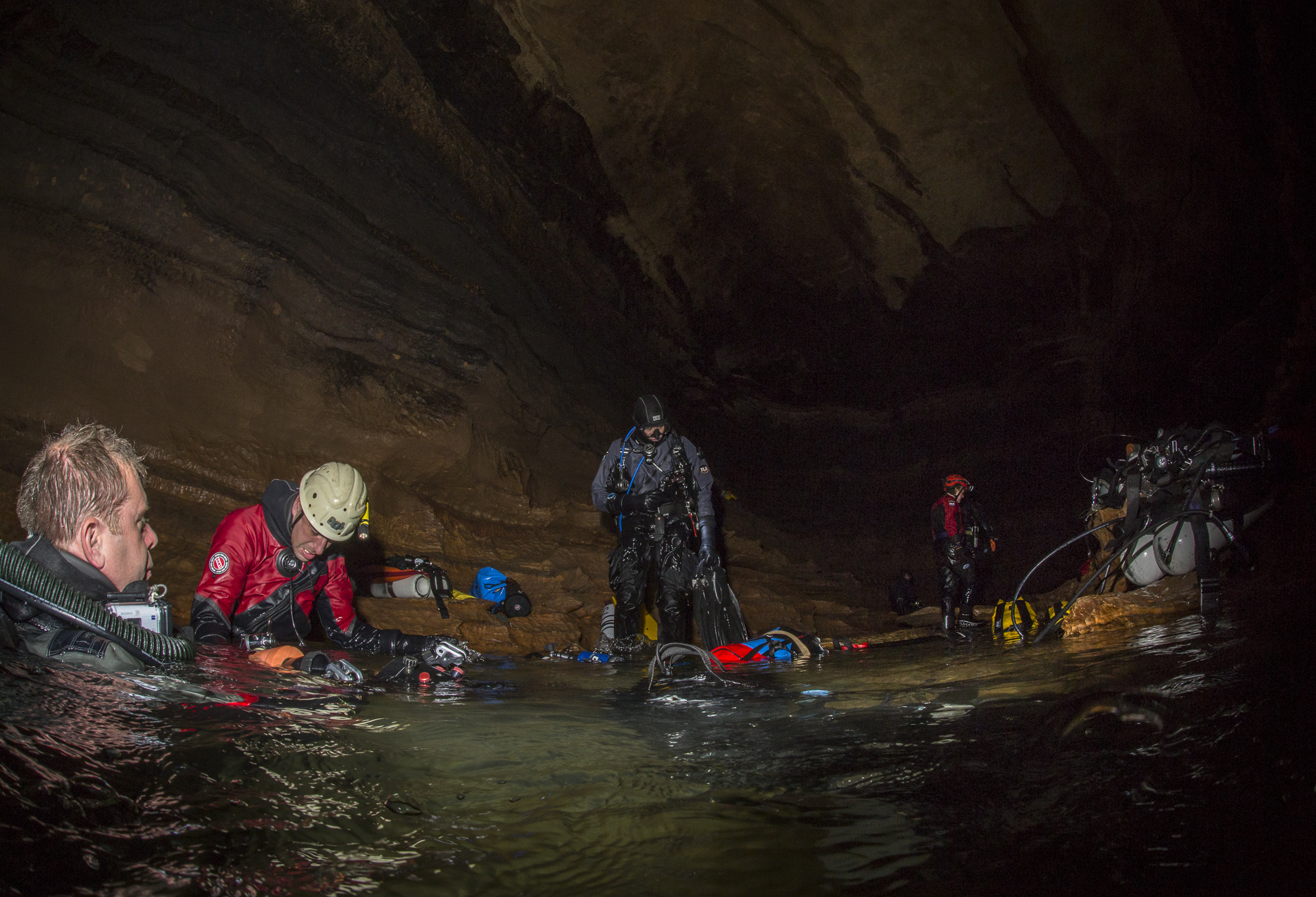
The Lake: The second part involves an underground lake with a large air space above. In some sections this lake is interrupted by short dry areas over which the equipment needs to be hauled across by a dedicated support team.
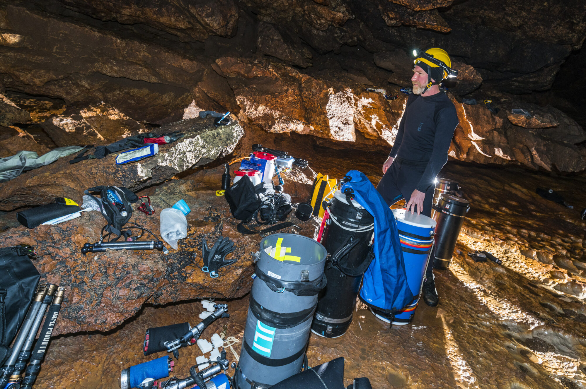
Sump 2: A short diving section of 50 m length. All the equipment required for multi day pushes inside the cave need to be brought beyond that point. The required equipment for multi-day cave camps includes food, sleeping bags, emergency equipment, radio communication instruments and surveying tools most of which we transport in dry tubes over the entire distance. Besides each team members own personal diving equipment we also bring additional dive equipment for the exploration dives in Sump 3.
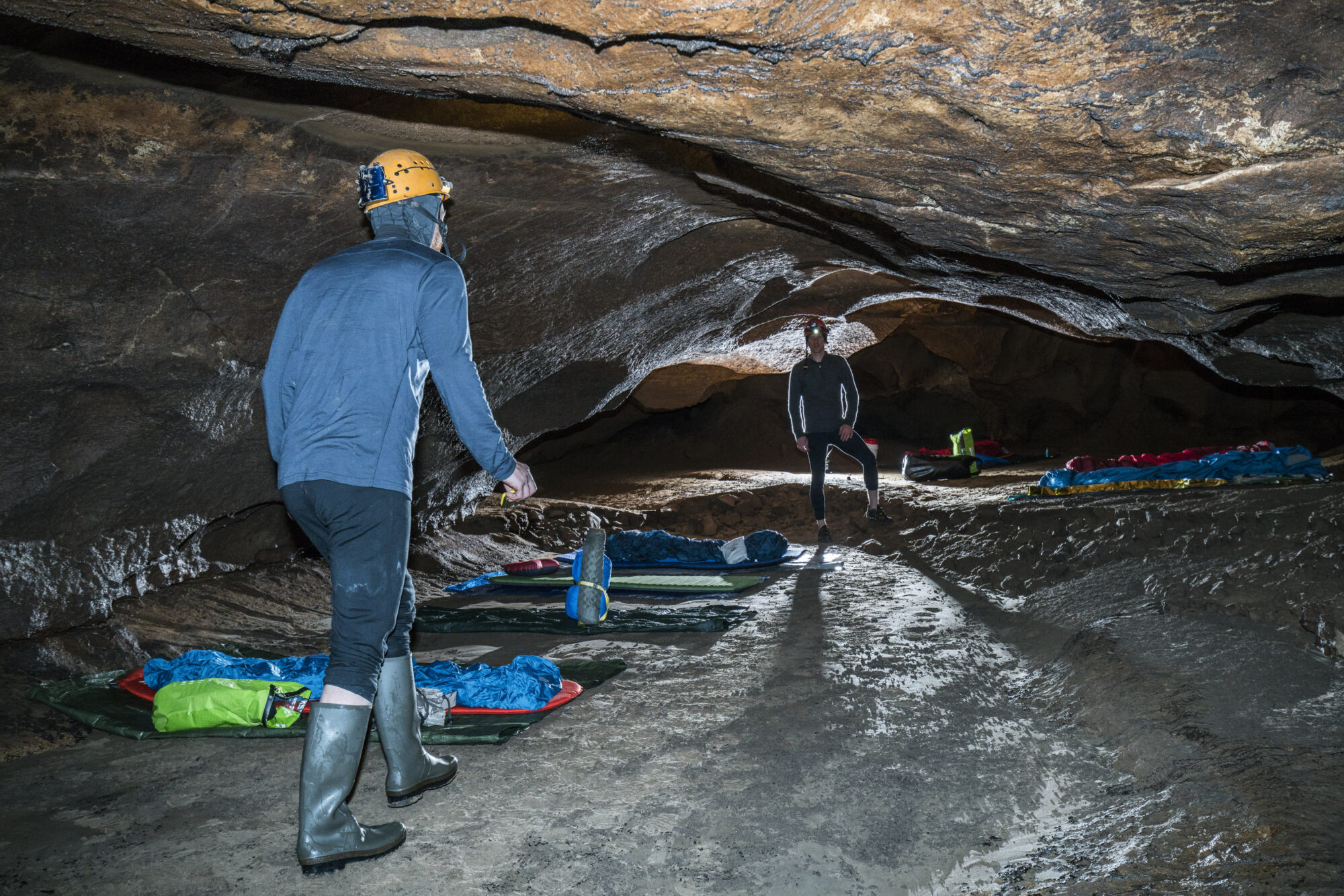
The bivouac chamber and dry passage: The fourth and currently most challenging part of the cave is a 800m long and mostly dry section. At the beginning of this part, we set up our base camp where we usually sleep for several days.
To reach the final dive section all dive equipment needs to be carried and swam along a narrow canyon followed by a breakdown area with huge boulders before a steep muddy slope finally leads to the next sump.
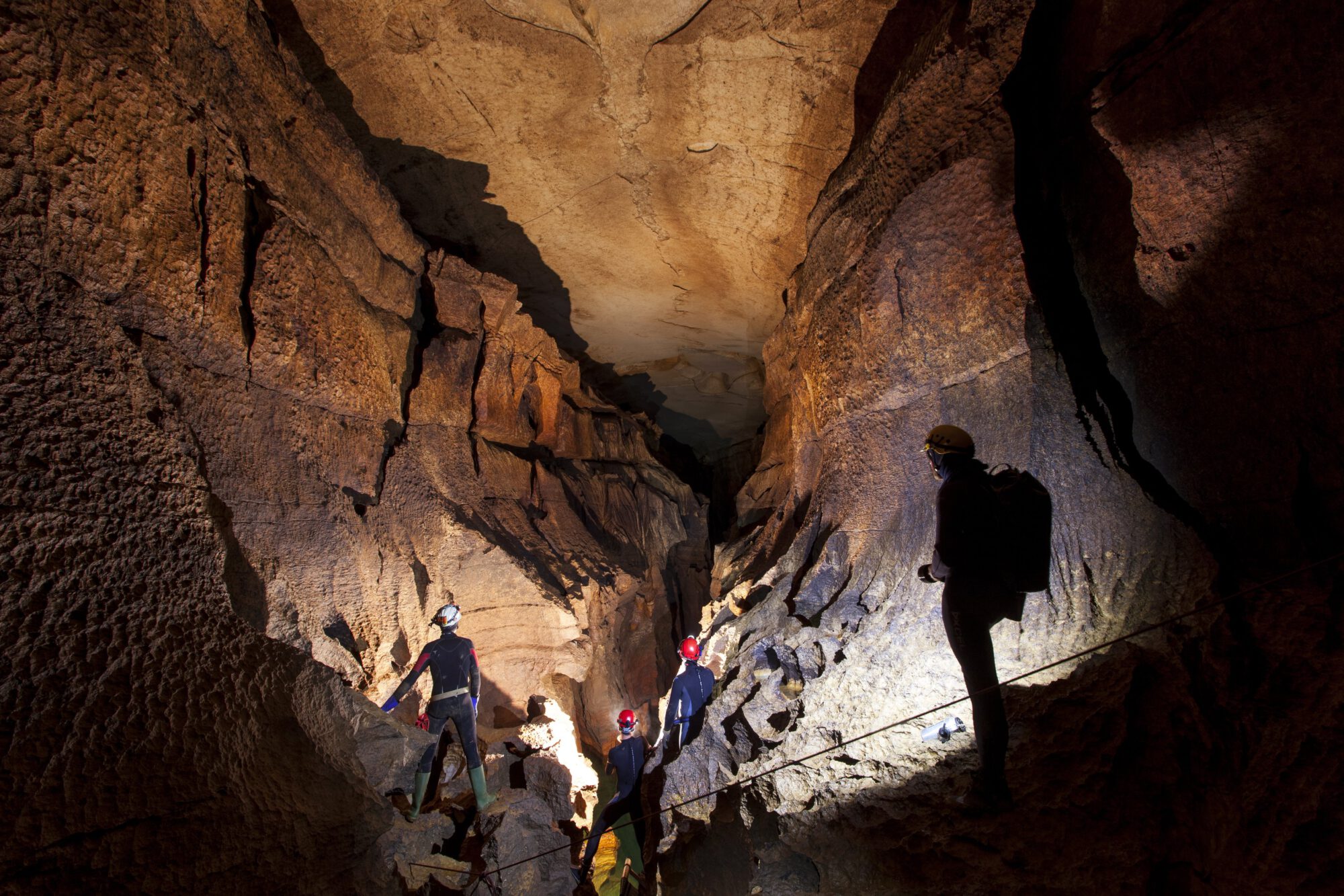
In order to aid the equipment carry in this challenging terrain we rigged the cave with climbing rope in several sections and installed a cable car system to the final sump.
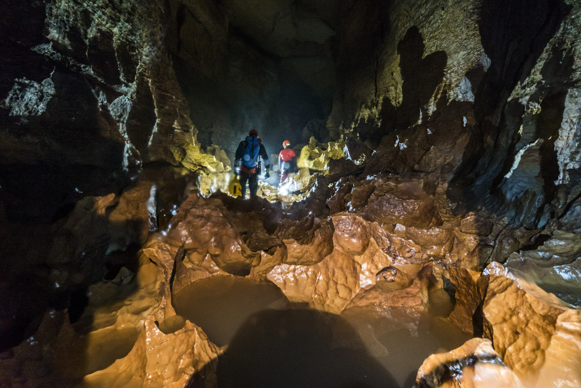
Sump 3: This is the current end of our exploration and over the year we mapped this section to a max distance of about 4 km from the exit and a depth of 130 m. Diving in Sump 3 is extremely challenging due to the generally poor visibility and great depth, requiring long hours of decompression.
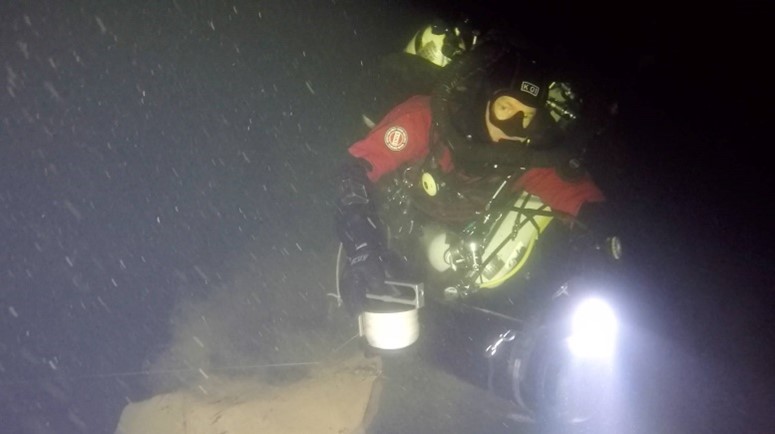
To continue the exploration of the cave, the team currently spends up to a week in the cave camping over 2.7 km away from the exit, living away from sunlight in 14°C temperature with 100% humidity and no luxuries such as warm showers or a soft bed.
Project vibes
Contact
Mail: info@thehiddenriverproject.org
Facebook: the hidden river project
Support the team
You also can support our team to continue exploring the cave system:
gofundme – Cave exploration @Cabouy